Protect blackbird natural area
Fix the code. Stop the clearcutting
Proposed Townsend Comprehensive Plan 2026 Update, p. 7.
How they're doing it...
Protected today
Under New Castle County Critical Natural Areas receive 100% protection from development.
New Castle County Unified Development Code, Table 40.10.010.
Vulnerable tomorrow...
Townsend's development code provides zero protections for Critical Natural Areas. Once land is brought in to Townsend it becomes vulnerable to development.
Townsend Municipal Code 24.36.090, Critical Natural Areas.
The plans for development are already set
Here's a video of Scott Lobdell of First State Engineering (Lobdell is also the Mayor of Townsend) and Rob Allen Jr of Handler Homes presenting a plan to develop the Dexter Corner Blackbird Natural Area in 2025...
Asked at that meeting what the comprehensive plan amendment would designate these parcels, Lobdell answered: “the ultimate proposal for that is gonna end up being residential.” They were designated farmland at the time.
Townsend's 2026 comprehensive plan has been updated to list area on the annexation list as residential zoning
Proposed Townsend Comprehensive Plan 2026 Update, p. 7.
Townsend eliminated its greenbelt from their 2026 land use map. Most of the land it wants to annex is now marked residential, including 395 acres of wetland and critical natural area.
Annexation changes which rules apply
When Townsend annexes adjacent properties, they lose the protections against unsustainable development they had under New Castle County. Townsend has not yet changed its own codes to match, despite state agency after agency recommending those updates. Why?
Forest and wetland protections in a CNA
Take action
Click the button and this message opens in your email app, already addressed to all five members of Council. Change anything you want, then send it.
Subject
Fix Townsend’s environmental code and keep Dexter Corner and Summit Bridge Rd Greenbelt
Message
I am asking the Townsend Town Council to update the Town’s environmental development protections before approving additional annexations. Annexed land should receive protections equivalent to those provided by New Castle County for Critical Natural Areas, mature forest, wetlands, and other high-value habitat.
I also ask Council to leave these parcels as the certified 2022 Future Land Use plan already has them, and not to adopt the 2026 changes that redraw them for residential and commercial growth:
- Dexter Corner north, parcel 14-016.00-008, 81.9 acres off Summit Bridge Road
- Dexter Corner south, parcel 14-016.00-009, 30.1 acres on Dexter Corner Road
- 6192 Summit Bridge Road, parcel 14-016.00-045, 15.47 acres
- 6196 Summit Bridge Road, parcel 14-016.00-046, 0.19 acres
- 6218 Summit Bridge Road, parcel 14-016.00-043, 10.0 acres
It opens addressed to Mayor Scott Lobdell and four Councilmen: Joseph Bangura, Matthew Chapman, Syed Sharif and Dylan Wiggins. Adding your street, or how long you have lived here, matters at a town meeting.
Call Town Hall
Ask one question: which Townsend rule replaces the County’s protection after annexation? Say you want it answered in public.
Call (302) 378-8082Send this to a neighbor
Most people near Townsend have never seen the two maps side by side. They are also likely unaware of the Mayor’s conflicts of interest.
Speak at a meeting
Public comment is short and it goes on the record. A short comment from a resident is impactful. Your voice matters.
Meetings are at Town Hall, 141 Main Street, Townsend. Schedule from the Town of Townsend events page, retrieved 3 September 2026.
What we want Council to do
Fix the environmental code before more annexations
Adopt protections equivalent to New Castle County’s for Critical Natural Areas, mature forest, wetlands, riparian areas, and other high-value habitat.
Keep Dexter Corner and Summit Bridge Rd greenbelt
These parcels should remain greenbelt (as it is on the existing Townsend 2022 comprehensive plan). Do not adopt the 2026 Future Land Use changes that redraw Dexter Corner and the Summit Bridge Road parcels for residential and commercial growth.
State reviewer’s warning
…this code is inadequate to protect the greater network of critical habitat that exists within the scope of the proposed annexations. Currently under New Castle County jurisdiction, several of these areas are offered 100% protection and are classified under resource preservation in the County’s 2022 Future Land Use Map. In contrast, annexing these parcels into Townsend would likely result in the elimination of high-value habitat unless the Town amends its code to implement additional environmental protection measures. To that point, the Town’s proposed Future Land Use & Growth & Annexation Map shows these areas as residential.
Delaware Office of State Planning Coordination, PLUS review of the Townsend annexations, 19 August 2026, p. 13.
Read the State’s letterThe maps and the aerial imagery
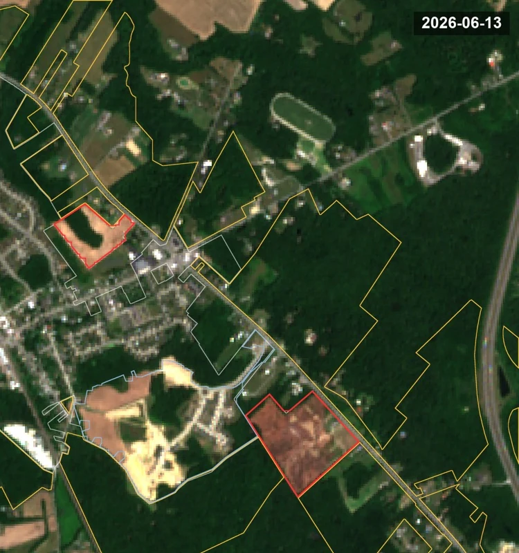
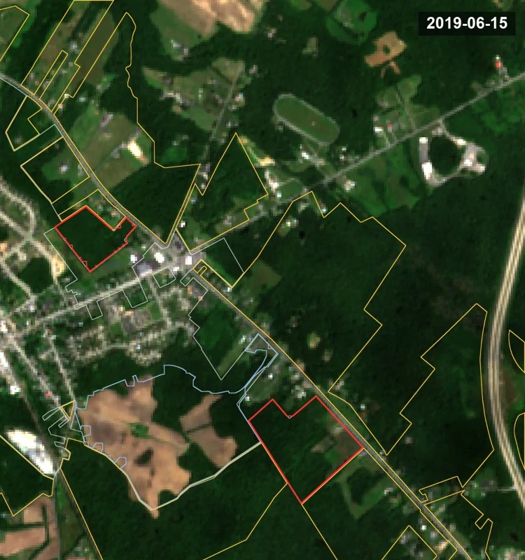
The same ground, 2019 and 2026
Two aerial images of the same frame, taken in mid-June seven years apart at the same scale. Drag the handle to compare.
The full map
Every layer behind this page will be on one map you can turn on and off yourself.